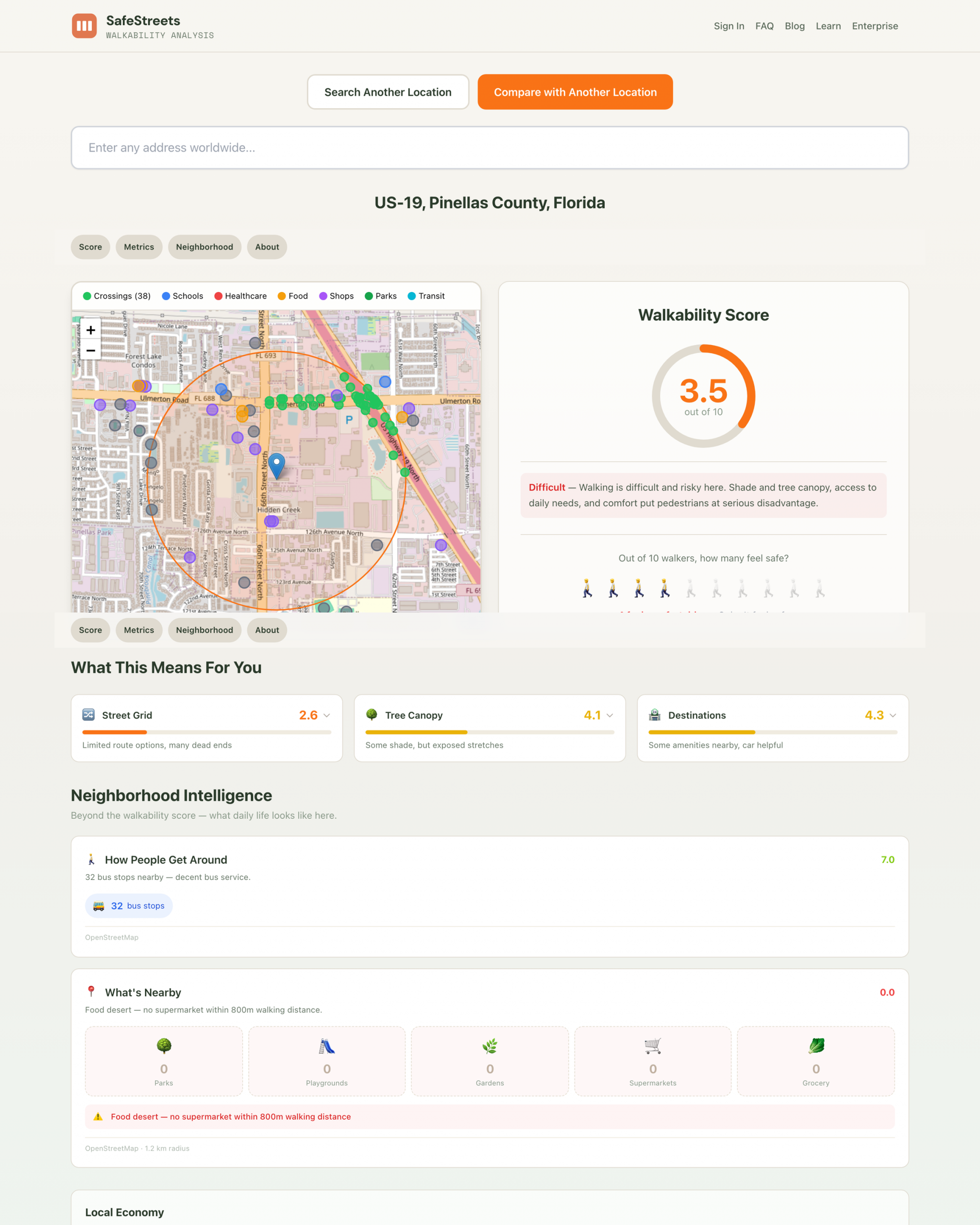
SafeStreets is a cutting-edge tool designed to evaluate and improve urban navigation by providing detailed walkability scores for any address around the globe.
Leveraging a comprehensive dataset that includes information from the Environmental Protection Agency, Centers for Disease Control and Prevention, FEMA, Census data, OpenStreetMap, and Sentinel-2 satellite imagery, it offers precise and reliable assessments of pedestrian-friendliness in neighborhoods worldwide.
Users can obtain a walkability score ranging from zero to ten, helping residents and city planners understand the accessibility and safety of specific locations.
One of its key features is the ability to generate professional PDF reports—simple, sharable documents perfect for discussions with city councils or stakeholders.
SafeStreets is entirely free to use, requires no account registration, and supports users across more than 190 countries, making it an invaluable resource for community development, urban planning, and enhancing walkability for all residents.